Project siting and facilities overview
If licensed, Cigeo will be built along the border of the Meuse and Haute-Marne departments in eastern France, where research conducted since the 1990s has identified a site with geology favourable to the construction of a deep geological disposal facility.
Siting Cigeo's facilities
Andra has been working with local stakeholders over the past few years to identify areas for siting Cigeo's underground and surface facilities. Many scientific, industrial, environmental and socio-economic criteria have been taken into account.
Defining the area where the disposal facility will be located
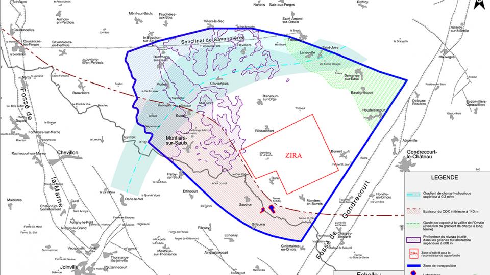
To study the siting of the underground facility, Andra proposed a 30 km² underground zone of interest for detailed survey to the French government in 2009. It is located in a 250 km² zone defined in 2005 and in which the results of the Underground Research Laboratory can be transposed.
The criteria taken into account for the choice of this zone are based on safety and geology (thickness of the layer, depth, etc.) as well as regional planning and local integration.
Andra’s proposed zone of interest for detailed survey, located five kilometres from the Underground Research Laboratory (URL), was approved by the government in 2010 following an opinion by the Nuclear Safety Authority (ASN), the National Assessment Board (CNE) and consultation with elected officials and the Local Information and Oversight Committee (CLIS) for the URL.
Andra subsequently made a new, more detailed geological survey, the results of which confirmed that the clay layer in the zone exhibits characteristics favourable to the siting of a deep geological disposal facility.
The location of the surface site
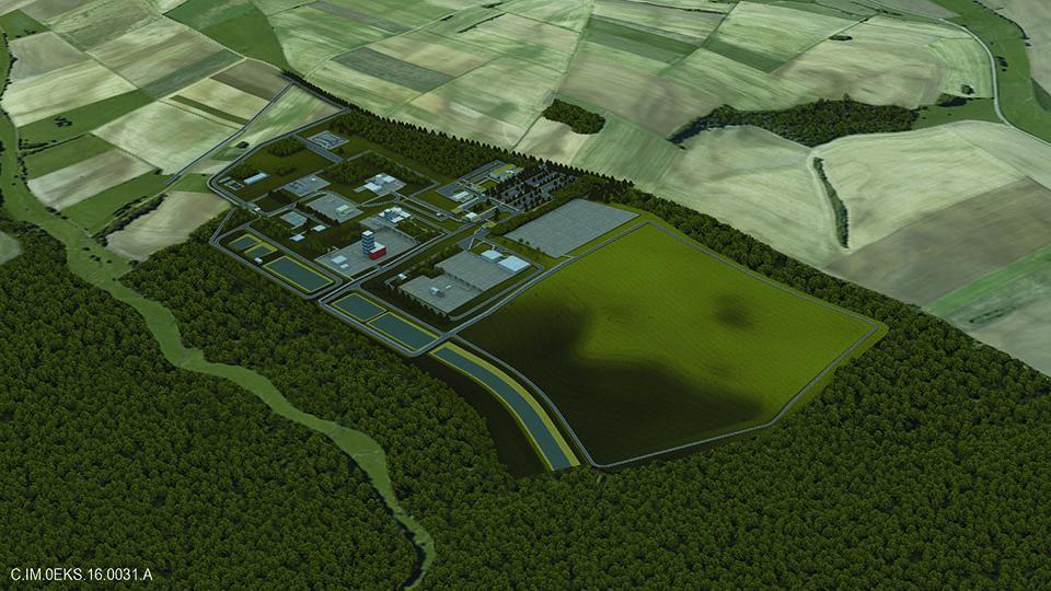
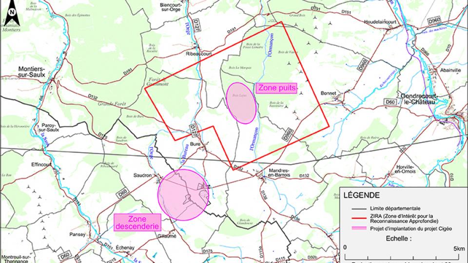
Cigeo's surface facilities will be split across two areas (known as the ramp and shaft zones) located a few kilometres apart. These areas were selected following an analysis that included environmental, safety, siting constraints, socio-economic data and transport infrastructure criteria, which were shared with the evaluators (ASN, IRSN, CNE) and presented to local stakeholders for their opinion as part of an information and dialogue process.
Overview of Cigeo
Underground facility
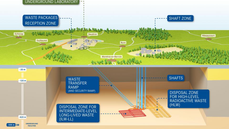
Located at a depth of approximately 500 metres, Cigeo's underground facility will be expanded over the course of its operations (as the waste packages will arrive gradually over time). It will consist of separate disposal zones for HLW and ILW-LL, connecting drifts and technical facilities. By its 100th year of operation, Cigeo will cover a surface area of approximately 15 km².
Robotic systems will place waste in horizontal tunnels, known as cells, excavated deep in the clay layer. HLW will be disposed of in metal-lined cells measuring a 150 metres in length and around 70 cm in diameter. ILW-LL will be disposed of in cells that are a few hundred metres long and some ten metres in diameter.
The disposal facility is designed to be expanded gradually with the construction of new waste disposal areas as radioactive waste arrives.
The waste reception area, or ramp zone
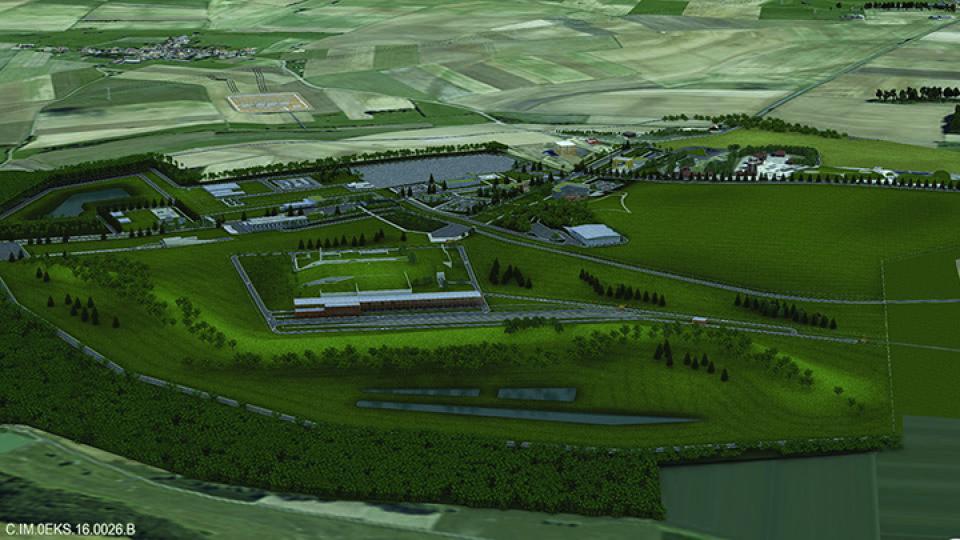
The ramp zone facilities, located between Meuse and Haute-Marne, will be used for receiving and inspecting waste packages and preparing them for transfer to the underground facility via a ramp. Measuring around 280 hectares, this area will consist of:
- a complex of nuclear facilities where waste packages will be received, inspected, conditioned into disposal packages and grouped together pending transfer to disposal cells
- a railway terminal
- equipment necessary for facility operation (e.g., electrical substations)
- buildings for receiving visitors
- employee facilities, including cafeteria and offices.
The work support zone known as the shaft zone
The facilities in the shaft zone, located in Meuse, will be used primarily for digging and building the underground structures as well as for disposal of slopes (cuttings resulting from digging) as the centre expands. This zone will extend over approximately 270 hectares at completion (i.e., once all slopes have been disposed of).
